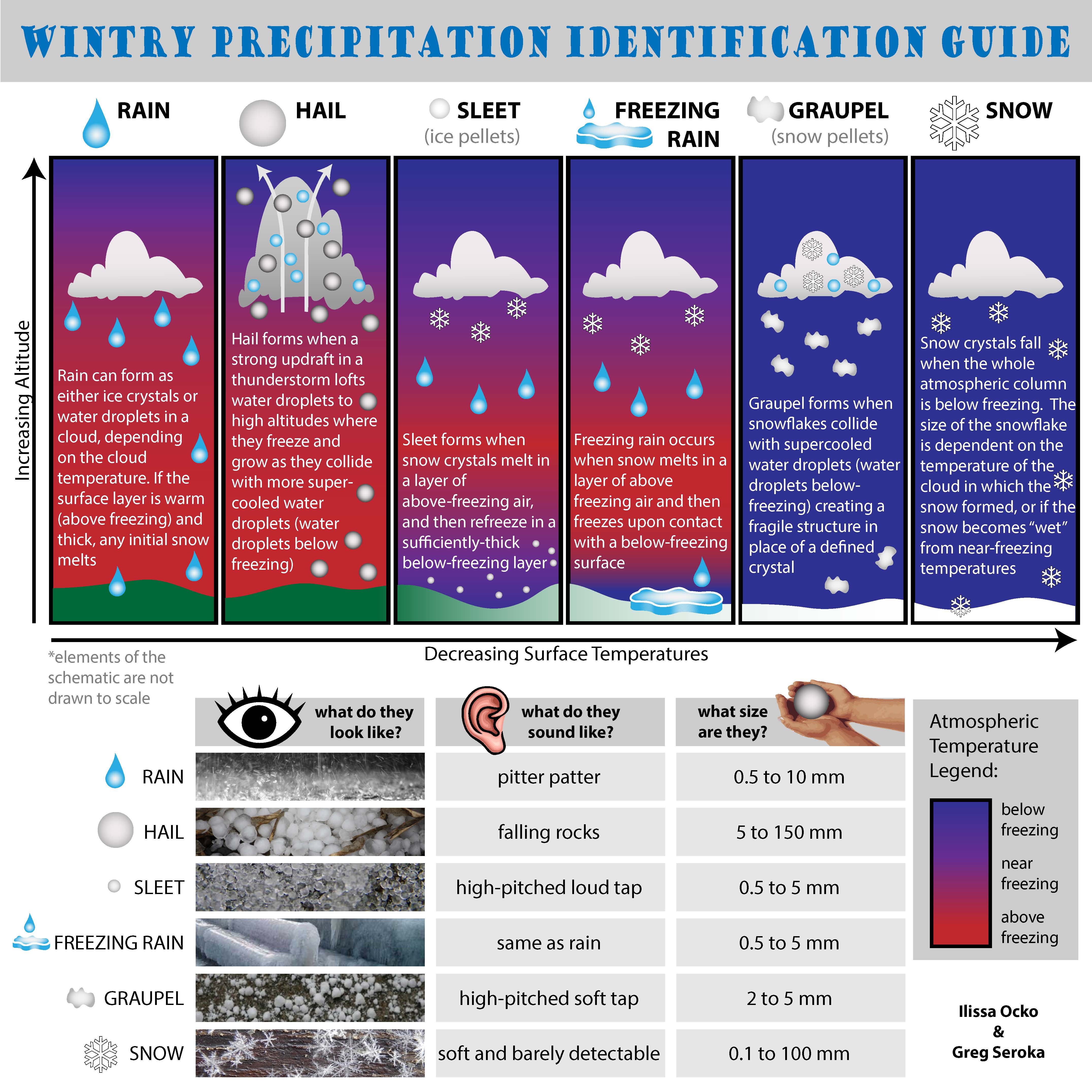
Infographic: Why Do Sleet & Freezing Rain Fall Instead of Snow?


One of the biggest issues this winter was (and continues to be) the incredible amounts of ice that fell in lieu of snow across much of the southern United States. Parts of Texas have seen several major ice storms in the last few months, and locations along the Gulf Coast saw over an inch of solid ice from sleet and freezing rain at the end of January — including Mobile, Alabama, which saw its worst winter storm in over two decades.
One of the most common questions asked this winter (aside from "when will it end?") is why sleet or freezing rain fell instead of snow, even though surface temperatures were often well below freezing.
Dan Satterfield's Wild Wild Science Journal recently featured an excellent infographic made by Ilissa Ocko and Greg Seroka that helps explain the difference between the different types of wintry precipitation, and why temperatures above ground level make all the difference between an thick coat of ice and a blanket of snow.
Click here for the infographic in full view on Dan's site.
[Infographic by Ilissa Ocko and Greg Seroka, republished with permission from Dan Satterfield. Thanks!]